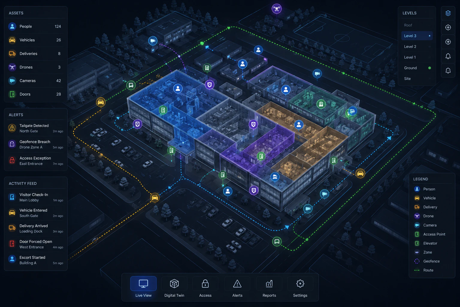
Operational Command
Real-time operational awareness and spatial intelligence across your entire facility footprint.
Explore the interactive spatial intelligence demo above
What is a Digital Twin?
A digital twin is a highly accurate virtual representation of physical assets, systems, and environments that mirrors real-world conditions in real-time. Within the Fortifye platform, it serves as the ultimate spatial intelligence layer.
By combining static data—such as facility layouts and infrastructure mapping—with continuous dynamic data streams including real-time sensor feeds, personnel locations, and access events, we create a comprehensive, live operational view.
- Unify disparate security feeds into a single command picture
- Transform spatial data into actionable operational superiority
- Bridge the gap between digital identity and physical presence
Vector-Based Rendering Engine
Unlike static image maps or heavy 3D models that lag under load, Fortifye utilizes a lightweight, high-performance vector-based rendering engine to deliver real-time spatial intelligence without compromising speed.
Zero Latency Navigation
Pan, zoom, and rotate across massive facility footprints instantly. Vector graphics ensure crisp resolution at any zoom level without pixelation.
Dynamic Data Overlay
Overlay live sensor data, access events, and personnel locations directly onto the vector map with millisecond precision.
Low Bandwidth Requirements
Operate efficiently even in constrained network environments. Vector data requires a fraction of the bandwidth compared to traditional raster maps.
Key Capabilities
Operational decision-making requires fluid context shifting. The digital twin empowers operators to move seamlessly between macro-level facility oversight and micro-level incident analysis.
Real-Time Operational Awareness
Examine specific areas in acute detail. Isolate loading docks, security checkpoints, or restricted zones to monitor precise activities, verify identities, and identify subtle operational anomalies as they happen.
Facility-Wide Spatial Intelligence
Maintain facility-wide situational awareness. Understand the overall operational flow, track mass movements during shift changes, and identify macro-level traffic patterns or emerging bottlenecks.
Deep Integration Capabilities
Connects directly with existing access control systems, visitor management platforms, and IoT sensors. The digital twin acts as the unified visualization layer for your entire security stack.
Practical Applications
Transforming spatial data into operational superiority across the most demanding and secure environments.
Military Installations
Orchestrate complex base security with live visitor tracking, automated vehicle screening, and strict zone-based access control.
Explore SolutionData Centers
Visualize server hall access, monitor critical equipment environments, and enforce zero-trust physical security perimeters.
Explore SolutionHealthcare Facilities
Manage high-volume visitor flow, coordinate emergency response teams, and secure restricted medical areas dynamically.
Explore SolutionTransportation Hubs
Maintain fluid operational command over vast areas, tracking vehicle flow, terminal access points, and screening queues.
Explore SolutionCorporate Campuses
Enable multi-building coordination, streamline employee Trusted Arrival, and orchestrate vendor logistics centrally.
Explore SolutionGovernment Facilities
Ensure strict compliance with federal access protocols while maintaining an active, real-time command picture.
Explore Solution